
Angoram topographic map
Interactive map
Click on the map to display elevation.
About this map
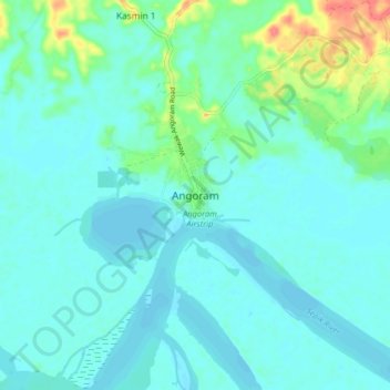
Name: Angoram topographic map, elevation, terrain.
Location: Angoram, East Sepik, Momase Region, Papua New Guinea (-4.09629 144.03290 -4.01629 144.11290)
Average elevation: 36 ft
Minimum elevation: -3 ft
Maximum elevation: 187 ft
Other topographic maps
Click on a map to view its topography, its elevation and its terrain.
Wewak District
Papua New Guinea > East Sepik > Wewak District
Wewak District, East Sepik, Momase Region, Papua New Guinea
Average elevation: 207 ft
Ambunti
Papua New Guinea > East Sepik > Ambunti
Ambunti, East Sepik, Momase Region, Papua New Guinea
Average elevation: 187 ft