
Kouba topographic map
Interactive map
Click on the map to display elevation.
About this map
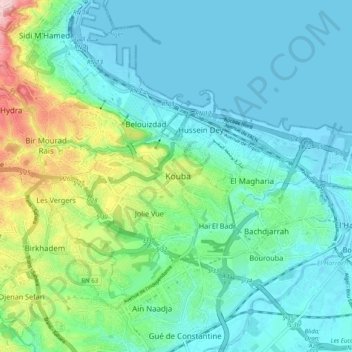
Name: Kouba topographic map, elevation, terrain.
Location: Kouba, Hussein Dey District, Algiers, 16040, Algeria (36.69244 3.04697 36.77244 3.12697)
Average elevation: 177 ft
Minimum elevation: -10 ft
Maximum elevation: 820 ft