
Almancil topographic map
Interactive map
Click on the map to display elevation.
About this map
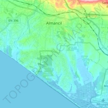
Name: Almancil topographic map, elevation, terrain.
Location: Almancil, Loulé, Faro, Portugal (37.01027 -8.07474 37.10797 -7.96478)
Average elevation: 95 ft
Minimum elevation: -10 ft
Maximum elevation: 709 ft
Due to an influx of tourism into the Algarve, the resident population of the parish expanded, resulting in the 18 December 1987 elevation of the parish to category of town.