
Karakulam topographic map
Interactive map
Click on the map to display elevation.
About this map
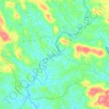
Name: Karakulam topographic map, elevation, terrain.
Average elevation: 187 ft
Minimum elevation: 69 ft
Maximum elevation: 436 ft
Other topographic maps
Click on a map to view its topography, its elevation and its terrain.
Nedumangad
India > Kerala > Nedumangad > Nedumangad
Nedumangad, Thiruvananthapuram, Kerala, 695544, India
Average elevation: 266 ft