
Parkdale topographic map
Interactive map
Click on the map to display elevation.
About this map
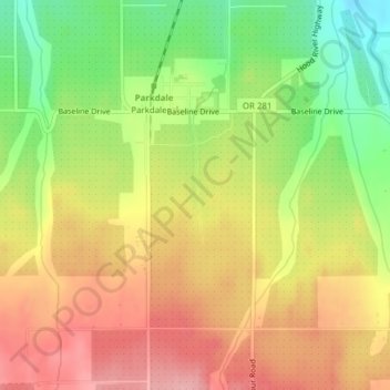
Name: Parkdale topographic map, elevation, terrain.
Location: Parkdale, Hood River County, Oregon, United States (45.50454 -121.59932 45.52308 -121.58631)
Average elevation: 1,765 ft
Minimum elevation: 1,532 ft
Maximum elevation: 1,959 ft