
Wannegem-Lede topographic map
Interactive map
Click on the map to display elevation.
About this map
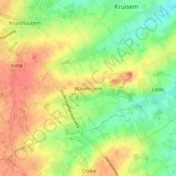
Name: Wannegem-Lede topographic map, elevation, terrain.
Location: Wannegem-Lede, Wannegem, East Flanders, Flanders, 9772, Belgium (50.87003 3.53107 50.91003 3.57107)
Average elevation: 141 ft
Minimum elevation: 49 ft
Maximum elevation: 226 ft