
Nemrut Dağı topographic map
Interactive map
Click on the map to display elevation.
About this map
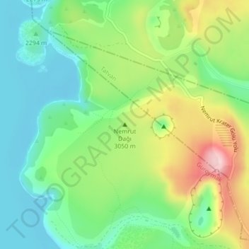
Name: Nemrut Dağı topographic map, elevation, terrain.
Location: Nemrut Dağı, Güroymak, Bitlis, Eastern Anatolia Region, Turkey (38.62245 42.24667 38.62255 42.24677)
Average elevation: 7,641 ft
Minimum elevation: 7,356 ft
Maximum elevation: 8,153 ft