
Khoni topographic map
Interactive map
Click on the map to display elevation.
About this map
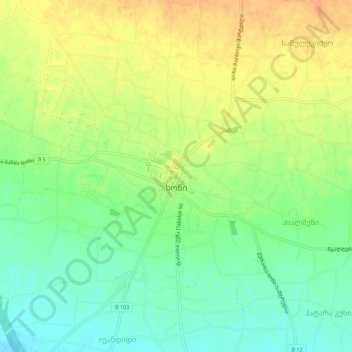
Name: Khoni topographic map, elevation, terrain.
Location: Khoni, Imereti, Georgia (42.30650 42.39362 42.34514 42.44795)
Average elevation: 384 ft
Minimum elevation: 325 ft
Maximum elevation: 443 ft