
Sterling topographic map
Interactive map
Click on the map to display elevation.
About this map
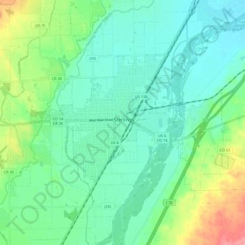
Name: Sterling topographic map, elevation, terrain.
Location: Sterling, Logan County, Colorado, 80751, United States (40.60136 -103.24911 40.64755 -103.13929)
Average elevation: 3,973 ft
Minimum elevation: 3,898 ft
Maximum elevation: 4,173 ft
Other topographic maps
Click on a map to view its topography, its elevation and its terrain.
Merino
United States > Colorado > Logan County
Merino, Logan County, Colorado, 80741, United States
Average elevation: 4,045 ft