
Mila topographic map
Interactive map
Click on the map to display elevation.
About this map
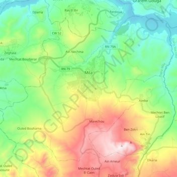
Name: Mila topographic map, elevation, terrain.
Location: Mila, Mila District, Mila, 43000, Algeria (36.37371 6.16220 36.50199 6.35539)
Average elevation: 1,759 ft
Minimum elevation: 515 ft
Maximum elevation: 4,111 ft