
Montezuma topographic map
Interactive map
Click on the map to display elevation.
About this map
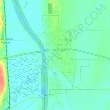
Name: Montezuma topographic map, elevation, terrain.
Location: Montezuma, Parke County, Indiana, 47862, United States (39.78180 -87.37740 39.80126 -87.35990)
Average elevation: 502 ft
Minimum elevation: 463 ft
Maximum elevation: 630 ft
Other topographic maps
Click on a map to view its topography, its elevation and its terrain.
Rocky Fork Lake
United States > Indiana > Parke County
Rocky Fork Lake, Parke County, Indiana, United States
Average elevation: 728 ft
Case Lake
United States > Indiana > Parke County
Case Lake, Parke County, Indiana, United States
Average elevation: 610 ft
Leatherwood
United States > Indiana > Parke County
Leatherwood, Parke County, Indiana, United States
Average elevation: 663 ft