
San Diego topographic map
Interactive map
Click on the map to display elevation.
About this map
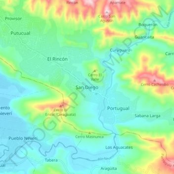
Name: San Diego topographic map, elevation, terrain.
Average elevation: 453 ft
Minimum elevation: 30 ft
Maximum elevation: 1,677 ft
Other topographic maps
Click on a map to view its topography, its elevation and its terrain.
Portugual
Venezuela > Anzoategui State > Municipio Sotillo
Portugual, Parroquia Hugo Chávez Frías, Municipio Sotillo, Anzoategui State, Venezuela
Average elevation: 545 ft
Puerto La Cruz
Venezuela > Anzoategui State > Municipio Sotillo
Puerto La Cruz, Parroquia La Cruz, Municipio Sotillo, Anzoategui State, 6023, Venezuela
Average elevation: 292 ft
Plaza de Chuparín general juan antonio sotillo
Venezuela > Anzoategui State > Municipio Sotillo > Puerto La Cruz
Plaza de Chuparín general juan antonio sotillo, Urbanización Chuparín, Puerto La Cruz, Parroquia La Cruz, Municipio Sotillo, Anzoategui State, 6023, Venezuela
Average elevation: 128 ft