
Chinchiná topographic map
Interactive map
Click on the map to display elevation.
About this map
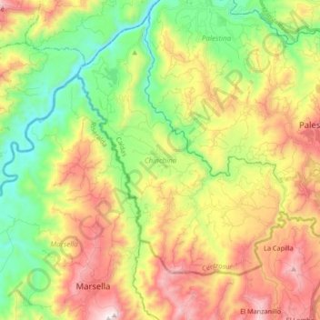
Name: Chinchiná topographic map, elevation, terrain.
Location: Chinchiná, Centrosur, Caldas, 176020, Colombia (4.92662 -75.74713 5.07755 -75.58067)
Average elevation: 4,879 ft
Minimum elevation: 3,045 ft
Maximum elevation: 8,812 ft