
São Caetano do Sul topographic map
Interactive map
Click on the map to display elevation.
About this map
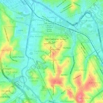
Name: São Caetano do Sul topographic map, elevation, terrain.
Average elevation: 2,490 ft
Minimum elevation: 2,398 ft
Maximum elevation: 2,677 ft
São Caetano do Sul is located on a plateau that is part of the Serra do Mar (Portuguese for "Sea Range"), part of the vast region known as the Brazilian Highlands, with an average elevation of around 800 meters (2,600 ft) above sea level – though at a distance of only about 70 kilometers (43 mi) from the Atlantic Ocean. Neighbouring municipalities are Santo André (East and South), São Bernardo do Campo (West) and São Paulo (North).