
Chambeshi topographic map
Interactive map
Click on the map to display elevation.
About this map
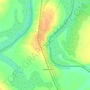
Name: Chambeshi topographic map, elevation, terrain.
Location: Chambeshi, Kanchibiya District, Muchinga Province, Zambia (-10.97325 31.04999 -10.93325 31.08999)
Average elevation: 3,911 ft
Minimum elevation: 3,855 ft
Maximum elevation: 3,973 ft
Other topographic maps
Click on a map to view its topography, its elevation and its terrain.
Chama
Zambia > Muchinga Province > Chama
Chama, Chama District, Muchinga Province, Zambia
Average elevation: 2,582 ft
Chinsali
Chinsali, Chinsali District, Muchinga Province, Zambia
Average elevation: 4,245 ft