
Grand-Reng topographic map
Interactive map
Click on the map to display elevation.
About this map
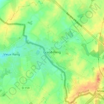
Name: Grand-Reng topographic map, elevation, terrain.
Location: Grand-Reng, Erquelinnes, Thuin, Hainaut, Wallonia, 6560, Belgium (50.30876 4.05059 50.34876 4.09059)
Average elevation: 456 ft
Minimum elevation: 400 ft
Maximum elevation: 522 ft
Other topographic maps
Click on a map to view its topography, its elevation and its terrain.