
Alcáçovas topographic map
Interactive map
Click on the map to display elevation.
About this map
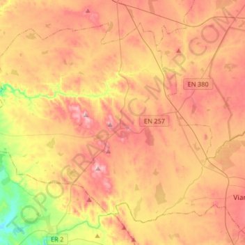
Name: Alcáçovas topographic map, elevation, terrain.
Location: Alcáçovas, Viana do Alentejo, Évora, Alentejo Region, Portugal (38.31281 -8.32257 38.48174 -8.05836)
Average elevation: 558 ft
Minimum elevation: 82 ft
Maximum elevation: 928 ft