
Penzance topographic map
Interactive map
Click on the map to display elevation.
About this map
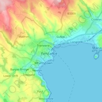
Name: Penzance topographic map, elevation, terrain.
Location: Penzance, South West England, England, TR18, United Kingdom (50.08132 -5.57293 50.16132 -5.49293)
Average elevation: 210 ft
Minimum elevation: -3 ft
Maximum elevation: 751 ft