
Spelthorne topographic map
Interactive map
Click on the map to display elevation.
About this map
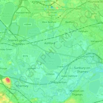
Name: Spelthorne topographic map, elevation, terrain.
Location: Spelthorne, Surrey, South East, England, United Kingdom (51.37841 -0.54063 51.47156 -0.38337)
Average elevation: 56 ft
Minimum elevation: 10 ft
Maximum elevation: 220 ft