
La Chapelle-en-Valgaudémar topographic map
Interactive map
Click on the map to display elevation.
About this map
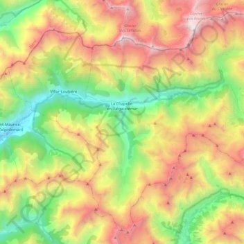
Name: La Chapelle-en-Valgaudémar topographic map, elevation, terrain.
Average elevation: 6,900 ft
Minimum elevation: 3,035 ft
Maximum elevation: 11,762 ft