
ساعة عين جالوت topographic map
Interactive map
Click on the map to display elevation.
About this map
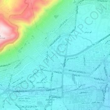
Name: ساعة عين جالوت topographic map, elevation, terrain.
Location: ساعة عين جالوت, Damascus, 0096311, Syria (33.50642 36.27718 33.54642 36.31718)
Average elevation: 2,493 ft
Minimum elevation: 2,208 ft
Maximum elevation: 3,766 ft