
Kediri topographic map
Interactive map
Click on the map to display elevation.
About this map
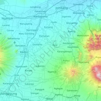
Name: Kediri topographic map, elevation, terrain.
Location: Kediri, East Java, Indonesia (-8.01206 111.79699 -7.59953 112.42225)
Average elevation: 974 ft
Minimum elevation: 82 ft
Maximum elevation: 9,285 ft