
Nedroma topographic map
Interactive map
Click on the map to display elevation.
About this map
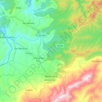
Name: Nedroma topographic map, elevation, terrain.
Location: Nedroma, Nedroma District, Tilimsen, Algeria (34.97721 -1.81524 35.11019 -1.67728)
Average elevation: 1,293 ft
Minimum elevation: 98 ft
Maximum elevation: 3,688 ft