
Pforzheim topographic map
Interactive map
Click on the map to display elevation.
About this map
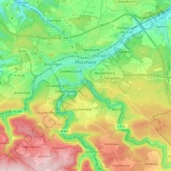
Name: Pforzheim topographic map, elevation, terrain.
Location: Pforzheim, Baden-Württemberg, Germany (48.81901 8.62474 48.92970 8.80874)
Average elevation: 1,276 ft
Minimum elevation: 696 ft
Maximum elevation: 2,201 ft