
Jilili topographic map
Interactive map
Click on the map to display elevation.
About this map
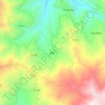
Name: Jilili topographic map, elevation, terrain.
Location: Jilili, Province of Ayabaca, Piura, Peru (-4.62500 -79.83716 -4.54500 -79.75716)
Average elevation: 5,121 ft
Minimum elevation: 2,628 ft
Maximum elevation: 8,711 ft