
Cagbalete Island topographic map
Interactive map
Click on the map to display elevation.
About this map
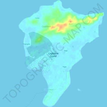
Name: Cagbalete Island topographic map, elevation, terrain.
Location: Cagbalete Island, Cagbalete Ⅱ, Calabarzon, Philippines (14.24844 121.80354 14.30656 121.85139)
Average elevation: 10 ft
Minimum elevation: -7 ft
Maximum elevation: 118 ft