
Marcus topographic map
Interactive map
Click on the map to display elevation.
About this map
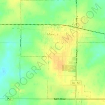
Name: Marcus topographic map, elevation, terrain.
Location: Marcus, Cherokee County, Iowa, United States (42.80645 -95.81926 42.83353 -95.78950)
Average elevation: 1,450 ft
Minimum elevation: 1,401 ft
Maximum elevation: 1,486 ft
Other topographic maps
Click on a map to view its topography, its elevation and its terrain.
Aurelia
United States > Iowa > Cherokee County
Aurelia, Cherokee County, Iowa, 51005, United States
Average elevation: 1,391 ft
Larrabee
United States > Iowa > Cherokee County
Larrabee, Cherokee County, Iowa, United States
Average elevation: 1,375 ft
Cherokee
United States > Iowa > Cherokee County
Cherokee, Cherokee County, Iowa, 51012, United States
Average elevation: 1,280 ft