
Canvey Island topographic map
Interactive map
Click on the map to display elevation.
About this map
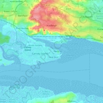
Name: Canvey Island topographic map, elevation, terrain.
Location: Canvey Island, Castle Point, Essex, England, United Kingdom (51.50075 0.51573 51.54768 0.70416)
Average elevation: 46 ft
Minimum elevation: -10 ft
Maximum elevation: 285 ft