
Malappuram topographic map
Interactive map
Click on the map to display elevation.
About this map
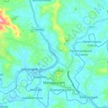
Name: Malappuram topographic map, elevation, terrain.
Location: Malappuram, Ernad, Malappuram District, Kerala, India (11.02631 76.03387 11.09641 76.10331)
Average elevation: 184 ft
Minimum elevation: 30 ft
Maximum elevation: 1,070 ft
Other topographic maps
Click on a map to view its topography, its elevation and its terrain.