
Mersin topographic map
Interactive map
Click on the map to display elevation.
About this map
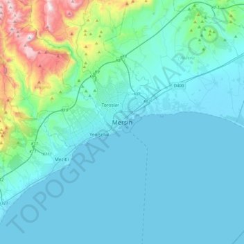
Name: Mersin topographic map, elevation, terrain.
Location: Mersin, Akdeniz, Mersin, Mediterranean Region, 33060, Turkey (36.63784 34.46984 36.95784 34.78984)
Average elevation: 489 ft
Minimum elevation: -3 ft
Maximum elevation: 3,891 ft