
Karnes City topographic map
Interactive map
Click on the map to display elevation.
About this map
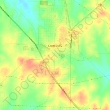
Name: Karnes City topographic map, elevation, terrain.
Location: Karnes City, Karnes County, Texas, United States (28.85746 -97.91361 28.90440 -97.88660)
Average elevation: 400 ft
Minimum elevation: 315 ft
Maximum elevation: 469 ft
Other topographic maps
Click on a map to view its topography, its elevation and its terrain.
Hobson
United States > Texas > Karnes County
Hobson, Karnes County, Texas, 78117, United States
Average elevation: 318 ft
Falls City
United States > Texas > Karnes County
Falls City, Karnes County, Texas, United States
Average elevation: 308 ft
Runge
United States > Texas > Karnes County
Runge, Karnes County, Texas, 78151, United States
Average elevation: 308 ft