
Beaufort West topographic map
Interactive map
Click on the map to display elevation.
About this map
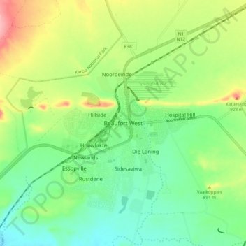
Name: Beaufort West topographic map, elevation, terrain.
Average elevation: 2,802 ft
Minimum elevation: 2,648 ft
Maximum elevation: 3,081 ft
Other topographic maps
Click on a map to view its topography, its elevation and its terrain.
Murraysburg
South Africa > Western Cape > Central Karoo District Municipality > Beaufort West Local Municipality
Murraysburg, Beaufort West Local Municipality, Central Karoo District Municipality, Western Cape, 6995, South Africa
Average elevation: 3,999 ft
Great Karoo
South Africa > Western Cape > Central Karoo District Municipality > Beaufort West Local Municipality
Great Karoo, Beaufort West Ward 2, Beaufort West Local Municipality, Central Karoo District Municipality, Western Cape, South Africa
Average elevation: 2,799 ft