
Araby topographic map
Interactive map
Click on the map to display elevation.
About this map
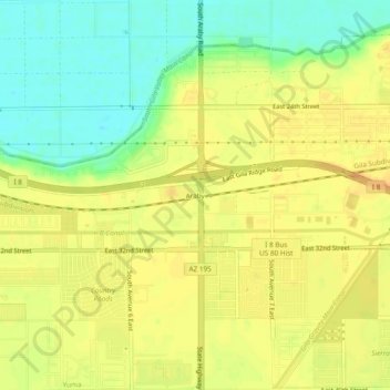
Name: Araby topographic map, elevation, terrain.
Location: Araby, Yuma, Yuma County, Arizona, 85365, United States (32.65560 -114.54217 32.69560 -114.50217)
Average elevation: 197 ft
Minimum elevation: 131 ft
Maximum elevation: 243 ft
Other topographic maps
Click on a map to view its topography, its elevation and its terrain.
Tuscan Ranch
United States > Arizona > Yuma County > Yuma
Tuscan Ranch, Yuma, Yuma County, Arizona, United States
Average elevation: 207 ft