
Castello topographic map
Interactive map
Click on the map to display elevation.
About this map
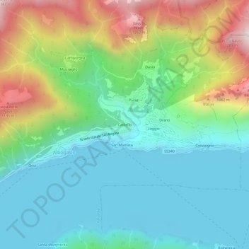
Name: Castello topographic map, elevation, terrain.
Location: Castello, CO, Lombardy, Italy (46.00809 9.03420 46.04809 9.07420)
Average elevation: 1,873 ft
Minimum elevation: 869 ft
Maximum elevation: 4,288 ft