
Sankt Johann im Pongau topographic map
Interactive map
Click on the map to display elevation.
About this map
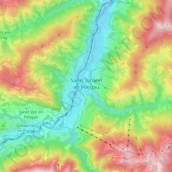
Name: Sankt Johann im Pongau topographic map, elevation, terrain.
Average elevation: 3,415 ft
Minimum elevation: 1,788 ft
Maximum elevation: 6,083 ft
Other topographic maps
Click on a map to view its topography, its elevation and its terrain.
Wagrain
Austria > Salzburg > Bezirk St. Johann im Pongau > Wagrain
Wagrain, Bezirk St. Johann im Pongau, Salzburg, 5602, Austria
Average elevation: 4,265 ft