
Mata Utu topographic map
Interactive map
Click on the map to display elevation.
About this map
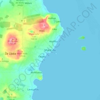
Name: Mata Utu topographic map, elevation, terrain.
Location: Mata Utu, Uvea, Wallis and Futuna, 98600, France (-13.32204 -176.21402 -13.24204 -176.13402)
Average elevation: 82 ft
Minimum elevation: 0 ft
Maximum elevation: 492 ft