
Kalpa topographic map
Interactive map
Click on the map to display elevation.
About this map
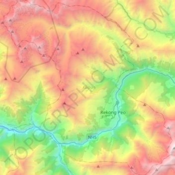
Name: Kalpa topographic map, elevation, terrain.
Location: Kalpa, Kinnaur district, Himachal Pradesh, India (31.45254 78.08760 31.70137 78.36968)
Average elevation: 12,392 ft
Minimum elevation: 5,482 ft
Maximum elevation: 21,188 ft