
Lismore topographic map
Interactive map
Click on the map to display elevation.
About this map
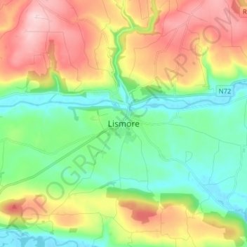
Name: Lismore topographic map, elevation, terrain.
Location: Lismore, County Waterford, Munster, Ireland (52.09680 -7.97305 52.17680 -7.89305)
Average elevation: 285 ft
Minimum elevation: -13 ft
Maximum elevation: 738 ft