
Kundapura topographic map
Interactive map
Click on the map to display elevation.
About this map
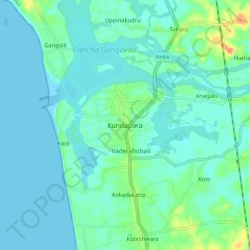
Name: Kundapura topographic map, elevation, terrain.
Location: Kundapura, Udupi district, Karnataka, 576200, India (13.58510 74.65157 13.66510 74.73157)
Average elevation: 26 ft
Minimum elevation: 0 ft
Maximum elevation: 128 ft