
Finhaut topographic map
Interactive map
Click on the map to display elevation.
About this map
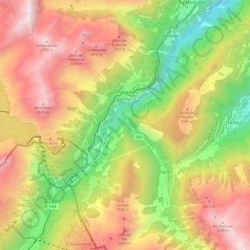
Name: Finhaut topographic map, elevation, terrain.
Location: Finhaut, Saint-Maurice, Wallis, 1925, Switzerland (46.04197 6.87207 46.10142 6.99262)
Average elevation: 5,676 ft
Minimum elevation: 2,152 ft
Maximum elevation: 9,242 ft
Other topographic maps
Click on a map to view its topography, its elevation and its terrain.
Les Granges (Salvan)
Switzerland > Wallis > Saint-Maurice
Les Granges (Salvan), Salvan, Saint-Maurice, Wallis, 1922, Switzerland
Average elevation: 3,560 ft
Mex (VS)
Switzerland > Wallis > Saint-Maurice
Mex (VS), Saint-Maurice, Wallis, 1890, Switzerland
Average elevation: 3,140 ft
Van d'en Haut
Switzerland > Wallis > Saint-Maurice > Salvan > Van d'en Haut
Van d'en Haut, Salvan, Saint-Maurice, Wallis, 1922, Switzerland
Average elevation: 5,404 ft