
Oakley topographic map
Interactive map
Click on the map to display elevation.
About this map
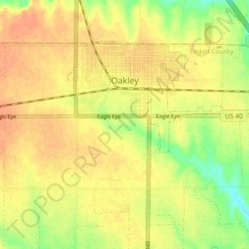
Name: Oakley topographic map, elevation, terrain.
Location: Oakley, Logan County, Kansas, United States (39.10085 -100.87031 39.13418 -100.80613)
Average elevation: 3,051 ft
Minimum elevation: 2,972 ft
Maximum elevation: 3,091 ft