
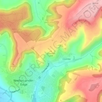
Coombe Hill topographic map
Interactive map
Click on the map to display elevation.
About this map
Name: Coombe Hill topographic map, elevation, terrain.
Average elevation: 489 ft
Minimum elevation: 167 ft
Maximum elevation: 810 ft
Other topographic maps
Click on a map to view its topography, its elevation and its terrain.
Sharpness
United Kingdom > England > Gloucestershire > Stroud
Sharpness, Stroud, Gloucestershire, England, GL13 9PE, United Kingdom
Average elevation: 56 ft
Hardwicke Green
United Kingdom > England > Gloucestershire > Stroud > Hardwicke
Hardwicke Green, Hardwicke, Stroud, Gloucestershire, England, GL2 4OD, United Kingdom
Average elevation: 69 ft
Whitminster
United Kingdom > England > Gloucestershire > Stroud > Whitminster
Whitminster, Stroud, Gloucestershire, England, GL2 7PT, United Kingdom
Average elevation: 69 ft