
The Bunker topographic map
Interactive map
Click on the map to display elevation.
About this map
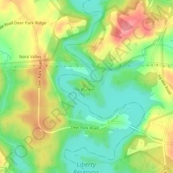
Name: The Bunker topographic map, elevation, terrain.
Location: The Bunker, Towson, Baltimore County, Maryland, USA (39.45533 -76.88753 39.45543 -76.88743)
Average elevation: 499 ft
Minimum elevation: 374 ft
Maximum elevation: 646 ft
Other topographic maps
Click on a map to view its topography, its elevation and its terrain.
Loch Raven Reservoir
Loch Raven Reservoir, Dulaney Valley Road, Towson, Baltimore County, Maryland, 21093, USA
Average elevation: 371 ft
Mingo Branch
United States > Maryland > Towson
Mingo Branch, Baltimore County, Maryland, 21120, United States
Average elevation: 568 ft
Hart-Miller Island
Hart-Miller Island, Towson, Baltimore County, Maryland, USA
Average elevation: 7 ft
Cromwell Valley Park
Cromwell Valley Park, Satyr Hill Estates, Towson, Baltimore County, Maryland, USA
Average elevation: 348 ft