
Philipsburg topographic map
Interactive map
Click on the map to display elevation.
About this map
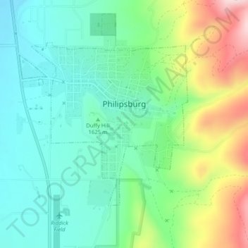
Name: Philipsburg topographic map, elevation, terrain.
Location: Philipsburg, Granite County, Montana, United States (46.32110 -113.31109 46.33887 -113.28447)
Average elevation: 5,404 ft
Minimum elevation: 5,079 ft
Maximum elevation: 6,132 ft
Other topographic maps
Click on a map to view its topography, its elevation and its terrain.
Hall
United States > Montana > Granite County
Hall, Granite County, Montana, 59837, United States
Average elevation: 4,236 ft
Mount Baldy
United States > Montana > Granite County
Mount Baldy, Granite County, Montana, United States
Average elevation: 6,047 ft