
Puerto Plata topographic map
Interactive map
Click on the map to display elevation.
About this map
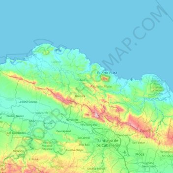
Name: Puerto Plata topographic map, elevation, terrain.
Location: Puerto Plata, D.R. (19.51209 -71.25689 19.93213 -70.36739)
Average elevation: 538 ft
Minimum elevation: 0 ft
Maximum elevation: 3,980 ft
Other topographic maps
Click on a map to view its topography, its elevation and its terrain.