
South Somerset topographic map
Interactive map
Click on the map to display elevation.
About this map
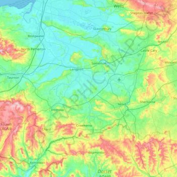
Name: South Somerset topographic map, elevation, terrain.
Average elevation: 272 ft
Minimum elevation: -7 ft
Maximum elevation: 1,076 ft
Other topographic maps
Click on a map to view its topography, its elevation and its terrain.
Castle Cary
United Kingdom > England > South Somerset > Castle Cary
Castle Cary, South Somerset, Somerset, South West England, England, BA7 7AX, United Kingdom
Average elevation: 253 ft
Cold brook
United Kingdom > England > South Somerset
Cold brook, South Somerset, Somerset, South West England, England, BA21 5TR, United Kingdom
Average elevation: 102 ft