
Precinct 13 topographic map
Interactive map
Click on the map to display elevation.
About this map
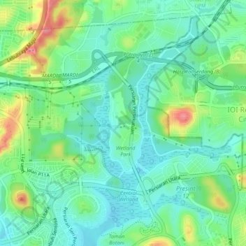
Name: Precinct 13 topographic map, elevation, terrain.
Location: Precinct 13, Putrajaya, 62502, Malaysia (2.94576 101.67596 2.98576 101.71596)
Average elevation: 164 ft
Minimum elevation: 72 ft
Maximum elevation: 371 ft