
Campana topographic map
Interactive map
Click on the map to display elevation.
About this map
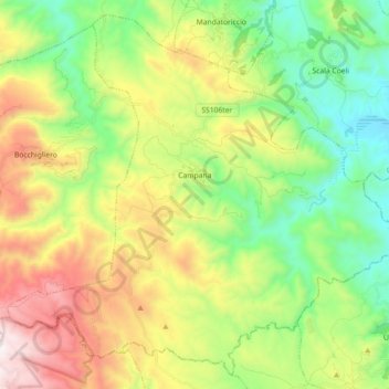
Name: Campana topographic map, elevation, terrain.
Location: Campana, CS, Calabria, Italy (39.34081 16.73589 39.46970 16.91575)
Average elevation: 1,962 ft
Minimum elevation: 328 ft
Maximum elevation: 4,672 ft