
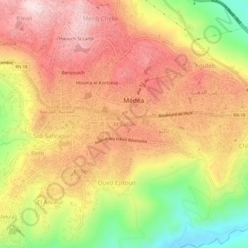
M'Sallah topographic map
Interactive map
Click on the map to display elevation.
About this map
Name: M'Sallah topographic map, elevation, terrain.
Location: M'Sallah, Médéa, Medea District, Médéa, 26000, Algeria (36.24147 2.74512 36.28147 2.78512)
Average elevation: 2,871 ft
Minimum elevation: 2,067 ft
Maximum elevation: 3,445 ft