
Louveigné topographic map
Interactive map
Click on the map to display elevation.
About this map
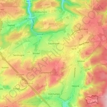
Name: Louveigné topographic map, elevation, terrain.
Location: Louveigné, Sprimont, Liège, Wallonia, 4141, Belgium (50.49555 5.67138 50.55433 5.76322)
Average elevation: 866 ft
Minimum elevation: 509 ft
Maximum elevation: 1,148 ft
Other topographic maps
Click on a map to view its topography, its elevation and its terrain.